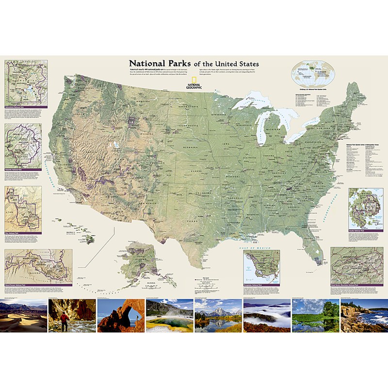
Expertly researched and designed, National Geographic's wall map of National Parks of the United States highlights the nearly 400 magnificent parks across America. The country is represented in subtle earth-tones with shaded mountain relief and intricately drawn river systems. Photos capture some of the diverse landscapes preserved and protected by the national park system.
Separate inset maps provide detail and descriptions of seven of the parks: Yellowstone, Yosemite, Acadia, Grand Canyon, Great Smoky Mountains, Everglades, and Zion. Parks located in U.S. territories are included on an inset world map. Includes insets of the Yellowstone, Yosemite, Acadia, Grand Canyon, Great Smoky Mountains, Everglades, and Zion National Parks, an inset world map showing outlying U.S. National Parks, a list of parks near metropolitan areas. Popular Places Included on the Map include Yellowstone, Yosemite, Denali, Joshua Tree, Acadia, Grand Canyon, Great Smoky Mountains, Hawai'i Volcanoes, Everglades, Zion, Mount Rushmore, Great Sand Dune, and Rocky Mountain national parks. The map is encapsulated in heavy-duty 1.6 mil laminate which makes the paper much more durable and resistant to the swelling and shrinking caused by changes in humidity. Laminated maps can be framed without the need for glass, so the frames can be much lighter and less expensive.
Expertly researched and designed, National Geographic's wall map of National Parks of the United States highlights the nearly 400 magnificent parks across America.
The country is represented in subtle earth-tones with shaded mountain relief and intricately drawn river systems.
Includes insets of the Yellowstone, Yosemite, Acadia, Grand Canyon, Great Smoky Mountains, Everglades, and Zion National Parks, an inset world map showing outlying U.S. National Parks, a list of parks near metropolitan areas.
The map is encapsulated in heavy-duty 1.6 mil laminate which makes the paper much more durable and resistant to the swelling and shrinking caused by changes in humidity.
Measures 42" x 30"
Ordering for a whole School or District? Call us for our Bulk Pricing or a Custom Quote!